Crowdsourcing and National Mapping - Phase 3
In the past number of years use of crowdsourcing by National Mapping and Cadastral Agencies (NMCA) has grown from being a disruptive technological idea to a mainstream source of geographic data and information. Today, many NMCAs and companies within the geospatial technologies industry use crowdsourcing (or Volunteered Geographic Information (VGI)) to update databases and registries. However, it is often difficult to find information about what projects or initiatives are currently in operation or have been used in the past. Where has crowdsourcing being used? What role did crowdsourcing play in collecting, editing or updating data and information for NMCAs, companies or other institutions?. The small project has two main objectives aims:
- Create VGI-ME (the VGI Map of Europe). We will gather information and examples on projects and initiatives in European National Mapping and Cadastral Agencies and geospatial companies/SMEs where crowdsourcing has been successfully implemented. VGI-ME will be a conceptual ‘map’ of projects from around Europe which used crowdsourcing as a means of collecting geospatial data and information.
- Plan the design and delivery of a VGI Hackathon which will feature the creation of new crowdsourcing applications (mobile and web) and extending/improving existing ones in order to make relevant VGI apps more versatile, more user-friendly, and more effective.
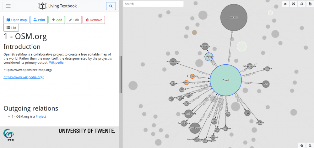
* The figure shows a prototype of the VGI conceptual map and an example VGI application
Related publications

Related workshops